Written by: Azizi Ali
In recent years, the Hidrokinetik Group has established itself as a leading player in providing hydrographic and geophysical surveys, marine engineering, and technical consultancy services in South-East Asia. The company began in 2013 with the establishment of Temasek Engineering, a specialist in marine sonar and telecommunication equipment. Since then, it has continued to expand, forming Temasek Allied Engineering in 2016 and Temasek Hidroteknik Sdn Bhd in 2018, which provides comprehensive hydrographic and geophysical survey services. In 2019, Hidrokinetik Technologies Sdn Bhd was established to focus on the design, development, and manufacture of autonomous unmanned surface vessels (USVs). Together, Temasek Hidroteknik Sdn Bhd and Hidrokinetik Technologies Sdn Bhd constitute an effective dynamic duo, offering expertise, equipment, and innovative solutions to clients’ project needs.
The Hidrokinetik Group works closely with INOS and UMT generally on various hydrographic, geophysical survey, and consultancy projects. One notable collaboration with UMT is in the field of ocean solutions through scientific research combining new technology and innovative approach, such as in the excavation of shipwrecks in Bidong Island. These collaborations help to keep the company and students informed of the latest developments and advancements in oceanography and hydrographic technology.
Meanwhile, to support maritime activities and prepare for hazards and disasters, the Malaysian Marine Forecast System (MFAST) has been developed by the First Institute of Oceanography (FIO) and UMT. Unlike the commercial Ocean Forecast Systems (OFS) which often lack accuracy at a local level, MFAST is designed to provide high-resolution forecast data. It is the first OFS in Malaysia to develop high-resolution ocean forecast data based on a wave-tide-circulation coupled model established by the Laboratory of Marine Sciences and Numerical Modelling (MASNUM), FIO.
MFAST provides up to 5 days of forecast data of ocean current, temperature, surface wave and wind between 3 °S – 15 °N and 96 – 123 °E at 3 hours intervals. This comprehensive, continuous, and reliable forecast data can be used for various marine-related activities such as maritime surveillance, navigation, search and rescue operations, recreation, and scientific exploration in the region.
The existence of MFAST has also increased cooperation with Hidrokinetic and other marine-related industries, such as oil and gas companies, who can use the forecasted in their daily operations. The collaboration between Hidrokinetik and INOS is expected to take MFAST further to be widely used unlimited to only the oil and gas industry or government agencies (such as the Fisheries, Meteorology, Marine departments). In recognition of Hidrokinetik’s capability and competency in oceanography surveys, a memorandum of agreement was signed to establish a start-up company in the hope of developing innovations in various oceanographic disciplines that meet the needs of the society.
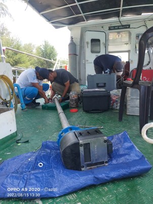
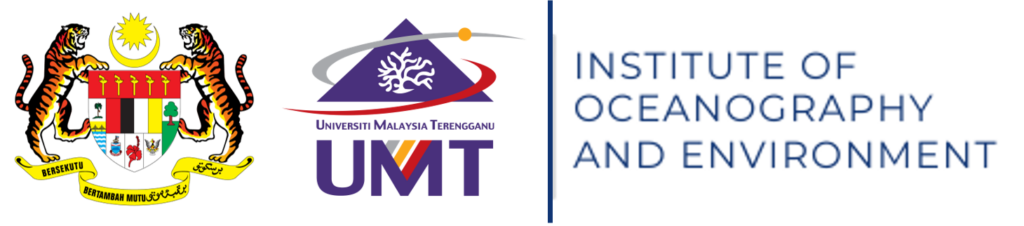
Figure 1 : Collaboration MBES survey between INOS and Hydrokinetik for MBES Survey.
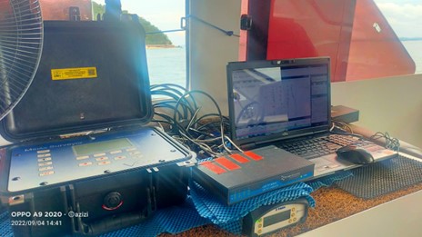
Figure 2 : MBES system used in collaboration work between INOS and Hydrokinetik.
Figure 3 : Industrial collaboration exchange between the Director of INOS and the Director of Hidrokinetik Sdn. Bhd.
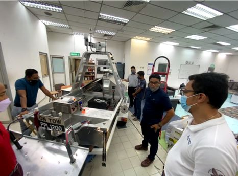
Figure 4 : Visit to Hidrokinetik Sdn.Bhd laboratory.

Copyright © INOS | Institute of Oceanography and Environment | Universiti Malaysia Terenganu | 2024. All rights reserved.