Designing Multiuse Zone via Marine Spatial Planning Approach for Marine Park Sustainability
By Mohd Safuan Che Din (INOS)
Under the Convention of Biological Diversity (CBD), Malaysia is one of the signatories in the convention that obligate to protect marine biodiversity and ecological integrity and the sustainable use of marine resources (UNEP 1994). Due to high diversity of marine organisms which support human and other marine life, Malaysia has taken an initiative to protect the marine ecosystem via establishment of Marine Protected Area (MPA) or known as Marine Parks (MPs) established under Part 41 of the Fisheries Act, 1985. The main goals are to protect, conserve, and manage in perpetuity representative marine ecosystems of significance, particularly coral reefs and their associated flora and fauna, so that they remain undamaged for future generations.
Among the MPs, Pulau Tioman Marine Park is an archipelago that consist of nine islands including the Pulau Tioman, the largest island in east coast of Peninsular Malaysia. The island hosts a wide range of critical marine ecosystems, including fringing coral reefs, rocky shores, sandy beaches, seagrass beds, mangrove forests, and open coastal environments. These diverse and highly productive ecosystems are of significant biodiversity, social, and economic importance to Malaysia. An economic valuation conducted by researchers at Universiti Utara Malaysia (UUM) estimated that the 14.5 km² reef area within the Tioman Island Marine Park contributes approximately RM3.4 billion annually to the economy. Given the ecological and economic value of these marine ecosystems, sustainable management is essential to ensure their long-term viability and continued benefits. This requires careful planning and the implementation of strategies aimed at preserving biodiversity while translating these ecological assets into sustainable economic gains. Future development initiatives on Pulau Tioman must prioritise environmental sustainability, integrating insights from diverse experts to achieve a balance between ecological conservation, community well-being, and tourism development. This approach will safeguard the island’s natural heritage and ensure its sustained contribution to both local and national prosperity.
Although the establishment of MPAs has covered a vast marine area, less than 2% of the world’s oceans are fully protected (Halpern, 2010). Depending on the political and economic context of each region, different countries use different approaches to design their MPAs. For example, the Australian government enacted the Great Barrier Reef Marine Park Act, 1975 (the Act) for the long-term conservation and protection of reefs (Hassan and Alam, 2019) by adopting marine spatial planning (MSP) via zoning strategies to minimise multiple conflicts and effectively manage 344,400 km2 of a large marine ecosystem (Kenchington and Day, 2011). In Malaysia, MSP has gained traction in environmental policy debates and government practise as an effective tool for adaptive and cross-scale management, providing mechanisms for resolving jurisdictional conflicts among stakeholders in the marine environment.
In line to the situation discussed, Universiti Malaysia Terengganu (UMT) and International Islamic University Malaysia (IIUM) in collaboration with Reef Check Malaysia, conducted a research entitled “Designing A Proposed Multi-Use Zones for Taman Laut Pulau Tioman: A Marine Spatial Planning Approach for Sustainable Marine Park Management” under the support from Department of Fisheries Malaysia. The purpose of this research is to design and propose a multi-use zone for the Pulau Tioman Marine Park via MSP approach for the sustainability of the marine ecosystem and development on the island. The project comprises of three major components: biodiversity, social and governance. Incorporating these findings into the MSP process will enhance the effective management of the marine park, strengthening its ability to protect and conserve biodiversity while promoting the sustainable use of marine resources. This approach also aligns with the National Policy on Biological Diversity (NPBD) and global agenda of Sustainable Development Goals (SGC) and United Nation Ocean Decade.
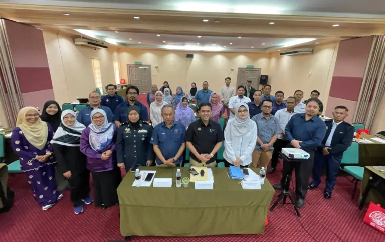
Figure 1: Focus Group Discussion (FGD) on multiuse zone of Pulau Tioman Marine Park among the stakeholder including federal and state government, NGO, universities and local community of Pulau Tioman.
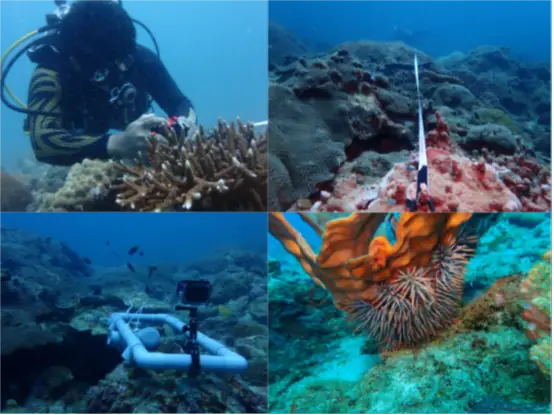
Figure 2: Assessment on coral reef communities in Pulau Tioman by the team from Institute of Oceanography and Environment (INOS) with International Islamic University Malaysia (IIUM).
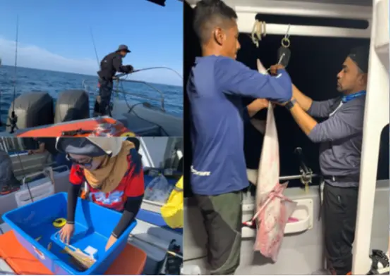
Figure 3: Inventory of fisheries population inside and outside of the marine parks.
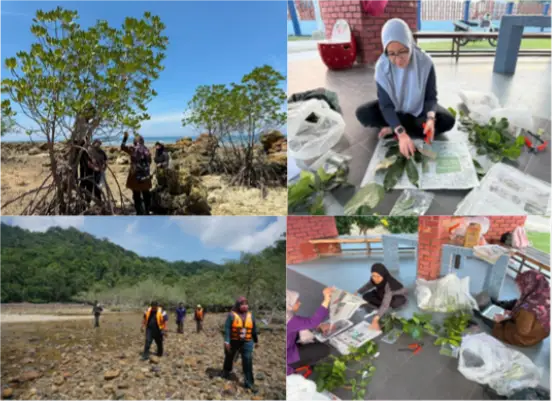
Figure 4: Inventory of mangrove species around Pulau Tioman by the team from International Islamic University Malaysia (IIUM), Kuantan.
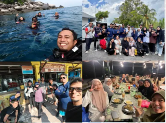
Figure 5: Enjoying the moments during field work at Pulau Tioman.