Menjelajahi Kedalaman Bawah Laut Pulau Tenggol
By Azizi Ali
Among all the beautiful islands that grace our country’s coastline, Pulau Tenggol, or Tenggol Island, stands as one of Malaysia’s most distinctive gems. Nestled in the embrace of Dungun, Terengganu, Tenggol Island boasts a unique tale of recent discovery and transformation. Formerly an untouched haven, Tenggol Island emerged from obscurity to become a favoured destination for travellers seeking unparalleled natural beauty and maritime wonders.
Pulau Tenggol’s allure stems not only from its breathtaking beauty but also from its status as a newfound treasure. This island was virtually unknown a few years ago, hidden from the world’s gaze. Its recent emergence from the shadows has captured the imagination of those drawn to its pristine shores. What was once a quiet, uninhabited oasis has undergone a remarkable metamorphosis, evolving into a sought-after haven for explorers seeking tranquillity and adventure.
A research effort is undertaken in important cooperation between the Department of Fisheries Malaysia and the Institute of Oceanography and Environment & Faculty of Science and Marine Environment at UMT. The “Hydrography Survey for Habitat Mapping at Tenggol Island, Dungun, Terengganu” initiative sets out to unravel the hidden nature of the undersea environment and pave a new path for marine spatial planning.
This ambitious endeavour aims to establish a comprehensive habitat map for marine park use. This map intends to provide critical assistance for marine spatial planning, which is vital for preserving and long-term managing our marine resources. The initiative relies on precise seabed mapping, a critical data collection component for informed decision-making.
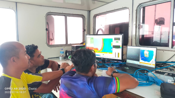
The devices that serve as our compass in the depths are:
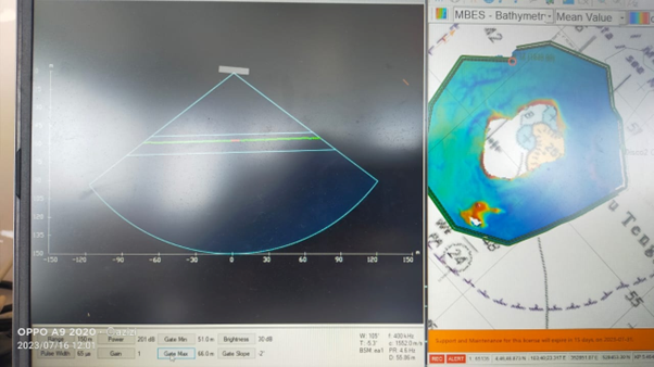
- Multibeam Echosounder System: A cutting-edge technology for imaging the seabed and uncovering its complicated shapes.
- Sound Velocity Profiler: An crucial tool for precisely measuring the speed of sound in water, which is required for accurate seabed mapping.
- Tide Gauge: A must-have instrument for monitoring tide changes and ensuring that mapping data accurately reflects the dynamic character of the undersea area.
- DGPS and heading: These navigation instruments assist our researchers through the ocean maze with precise accuracy.
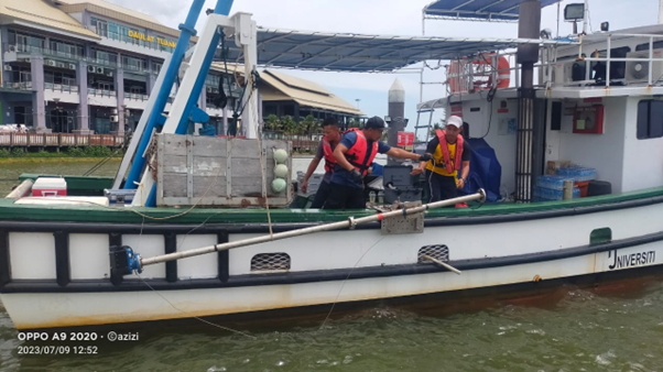
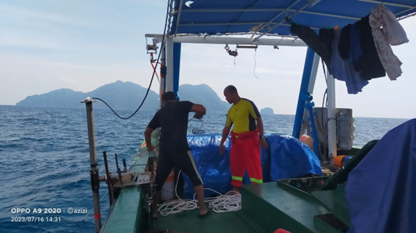
The crew embarks on a 10-day expedition from the 9th to the 18th of July 2023 onboard the beautiful ship Discovery 2, UMT, to explore the unknown seas surrounding Tenggol Island. The trip offers a richness of scientific discoveries and a profound connection to the ocean’s depths.
This joint effort, which brings together the knowledge of the Department of Fisheries Malaysia, the Institute of Oceanography and Environment, and the Faculty of Science and Aquatic Environment at UMT, demonstrates the value of collaboration in revealing the mysteries of our aquatic environment. We anxiously await the outcomes that will affect the future of marine conservation and spatial planning as the seas wash against the shores of discovery. Keep an eye out for the reveal of the hidden beauties under the surface.