
Sediment Distribution and Littoral Drift Direction for the Coastline between Batu Rakit and Setiu, Terengganu.
The main objective of this study is to determine the sediment distribution and investigate the net littoral drift direction from Batu Rakit to Kuala Setiu. The study is very important as a preliminary study to any coastal zone management decisions. The study area is located on the East Coast, influenced by the Northeast monsoon season (November-March) that is characterised by strong currents and high-energy waves.
Sediment characteristics and beach profiles were studied from Kg. Batu Rakit to Kuala Setiu. Beach sediment was found to be coarser during the Northeast monsoon season (November – March) and ranged between -0.33 to 1.91 phi. The sediment was also poorly-sorted and negatively-skewed during this season. For the beaches at Pantai Merang, sediment transportation is interrupted by a breakwater resulting in a wider beach due to accumulation of sediment.
In general, beach slopes followed the normal relationship of wider beaches having gentler slopes while steeper slopes have narrower beaches. Beach slope ranged from 0.01 (0.6°) to 0.51 (29.2°). Beach width ranged from 60 m to 120 m with little-or-no definite pattern.
The littoral sediment transport rate at the study area is 64,757 cubic meters per year. The littoral sediment transport rate was measured at 123,278 cubic meters per year during the Northeast monsoon season and 6,237 cubic meters per year during the non-monsoon season.
Littoral drift direction generated by longshore current and beach drift was determined to be from Southeast to the Northwest. The littoral drift was interrupted by a breakwater at station P7 (Kg. Merang) resulting in less sediment source at the downdrift (Kg. Telaga Papan) and forming a sandbar. In this study, the breakwater has been successfully used as a site-specific indicator for determination of net littoral drift direction at Merang coastline. The littoral drift direction at Kg. Merang is heading to the Northwest; changes its direction to the Southwest causing sediment accretion at the entrance of the breakwater. The sandbar was created here in response to wave action and prograde in the direction of littoral drift. The impacts to Kg. Telaga papan beach are coarser sand, poorly-sorted sediment types, steeper and narrower beach; and beach cusps formation in downdrift zone.
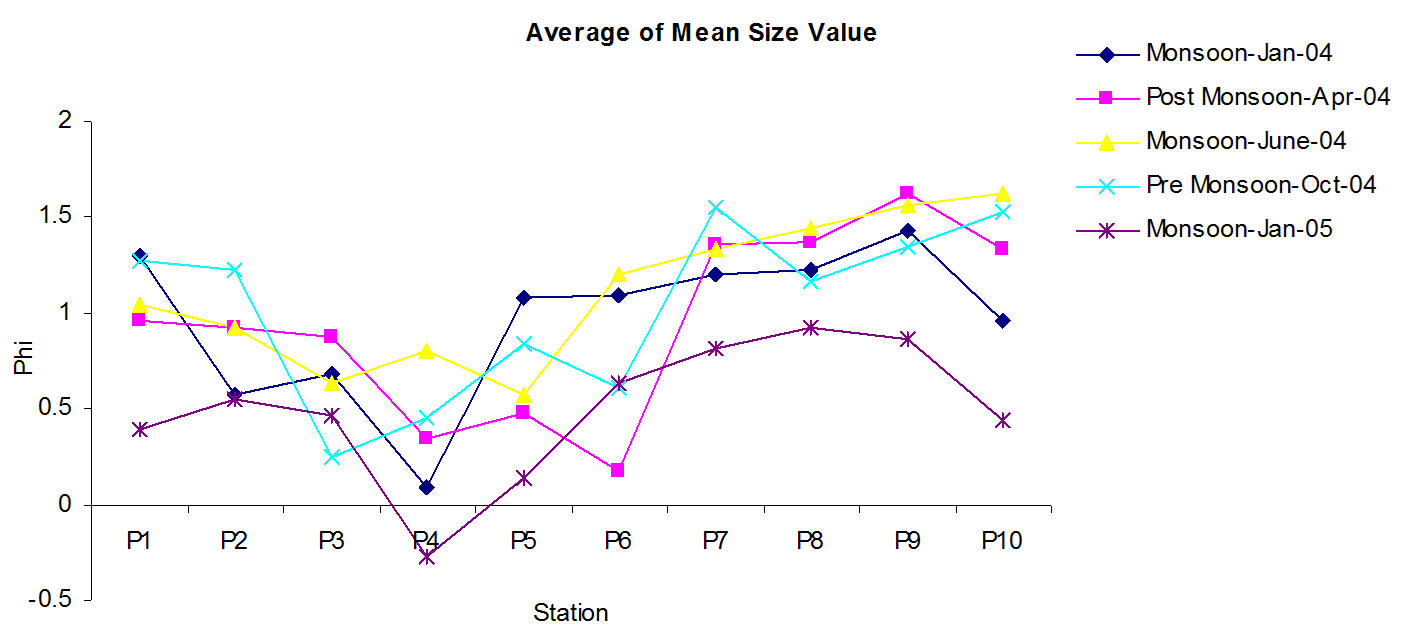
Seasonal comparison of mean size value
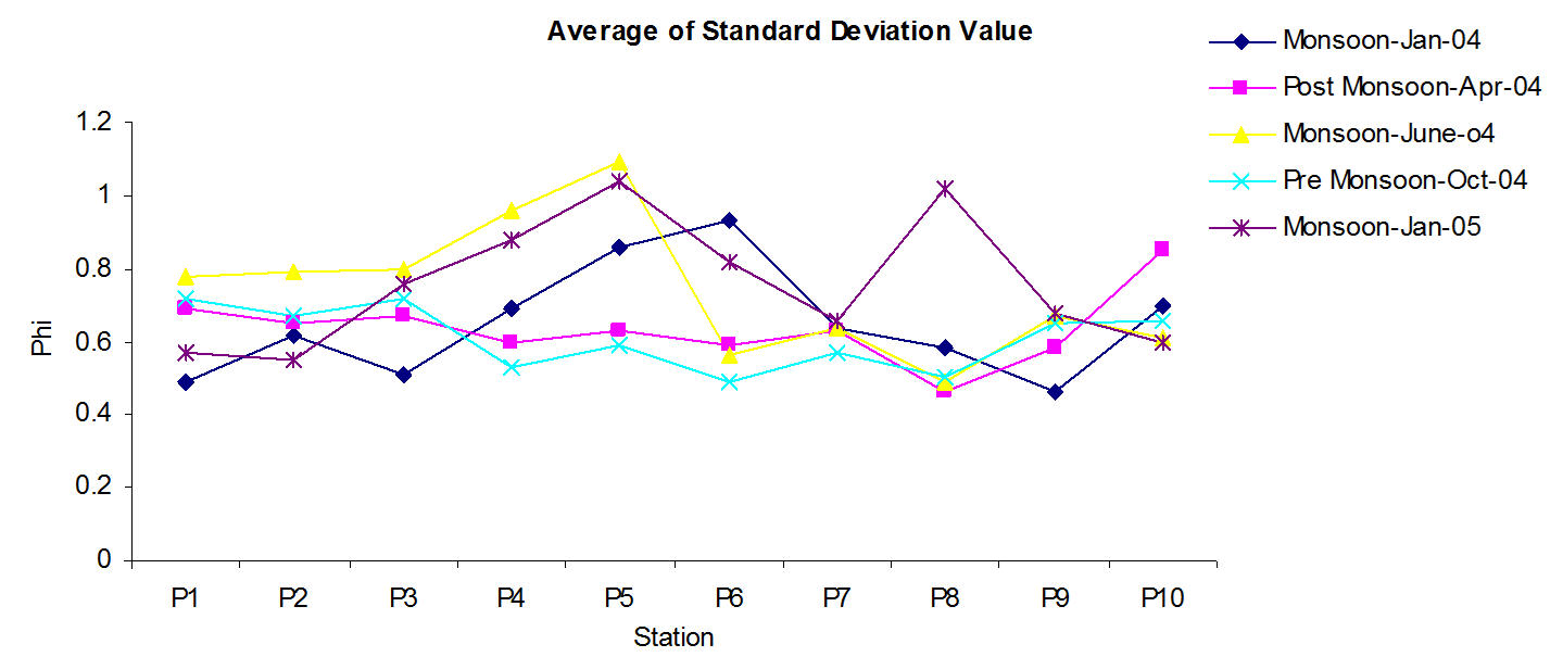
Seasonal comparison of standard deviation (Sorting) value
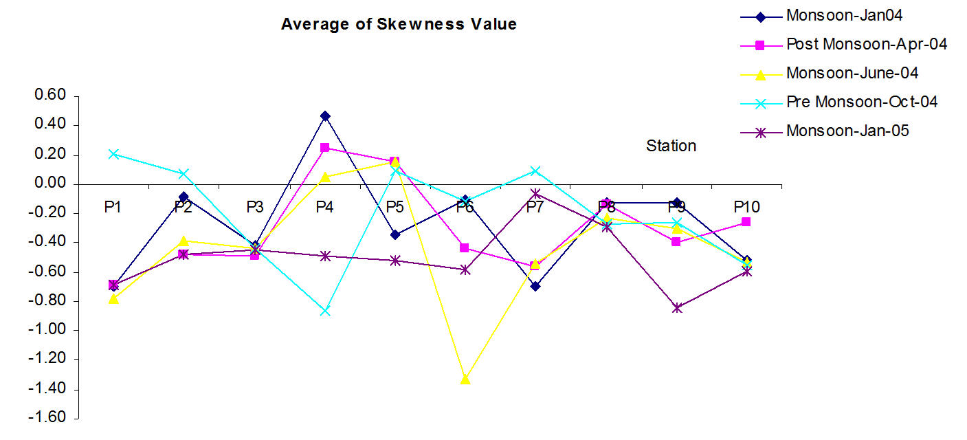
Seasonal comparison of skewness value
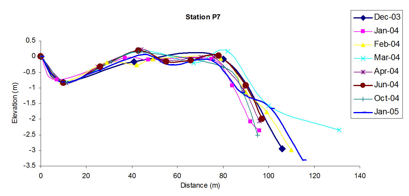
Annual changes in beach profile – Station P7 (December 2003 – January 2005)
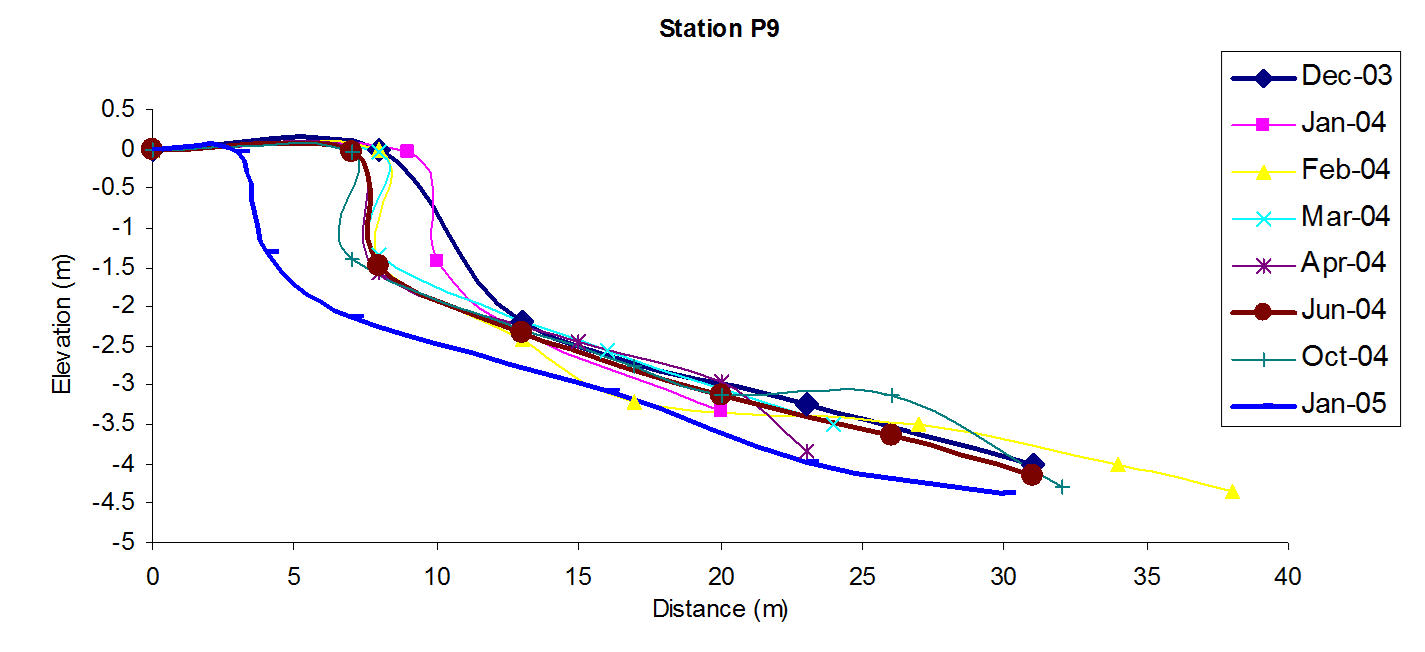
Annual changes in beach profile – Station P9 (December 2003 – January 2005)
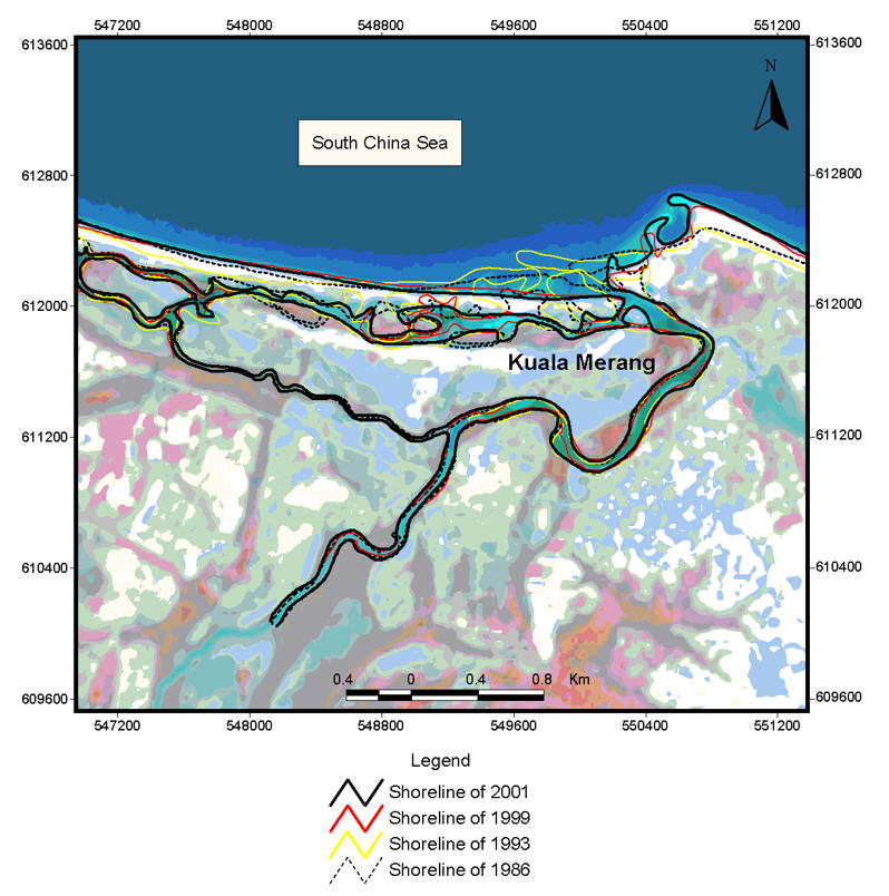
SPOT image map showing coastal changes at Kuala Merang
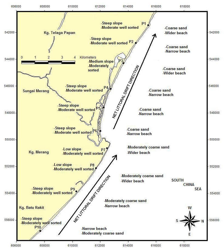
Relationships between sediment size, beach slope and littoral drift direction
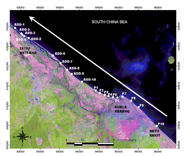
Net littoral drift direction at the study area
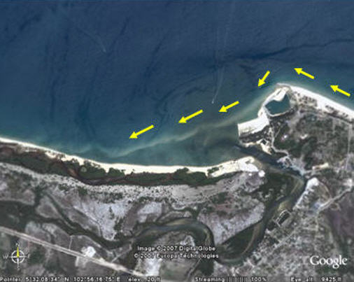
Sandbar image as taken from Google Map
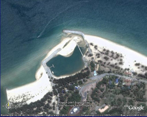
Sedimentation closed the jetty entrance (taken from www.googleearth.com)
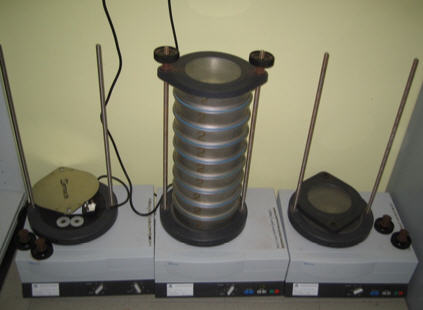
Electronic Shaker (Retsch-Germany)
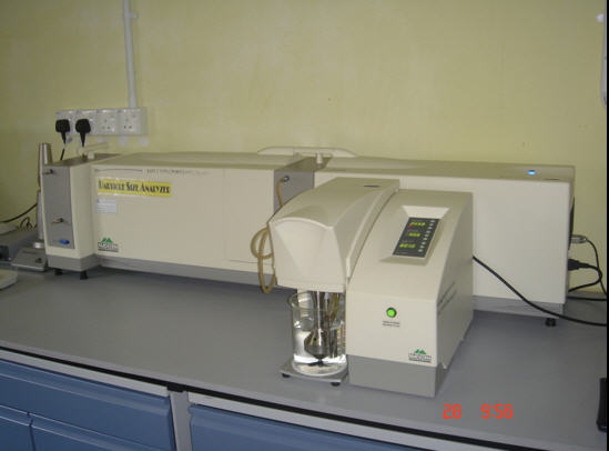
Malvern Particle Size Analyser (UK)
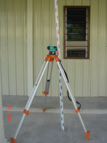
Transit SOKKIA C410 (Japan)
Biodata of the Author

Mohd Azam bin Mat Yaacob
– Sciencer Officer at Institute of Oceanography and Environment (INOS), Universiti Malaysia Terengganu (UMT).
– B. Sc. degree in Marine Science (2002) Universiti Putra Malaysia Terengganu (UPMT).
– Master of Science Oceanography (Coastal Processes) (2010) Universiti Malaysia Terengganu.

